So what is the site about?
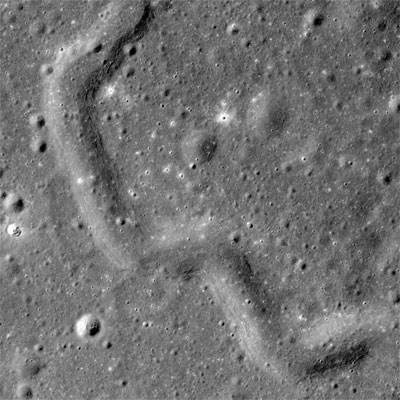
Launched in June 2009, NASA’s Lunar Reconnaissance Orbiter has spent the past five-and-a-bit years mapping the surface of our Moon, with the initial goal of identifying safe landing sites for future manned missions. Its camera, the LROC, is one of seven instruments on board the spacecraft; together, these instruments transmit about 155 GB of data back to their Earth-bound controllers every day. This steady stream of data has, naturally, created some challenges for the LROC’s science team. As they stated on the camera’s website, “When you have over a million individual images of the Moon, what do you do with them?” Part of the team’s response has been to develop this website, which contains several impressive visualizations and tools to help scientists (and curious onlookers) explore some of the fascinating and beautiful images in the LROC’s archive.
What can I do on the site?
Amateur lunar enthusiasts will have fun with the site’s Gigapan tool, which makes it possible for casual visitors to explore the LROC Northern Polar Mosaic. This composite image contains 680 gigapixels of valid image data and covers a patch of the Moon that, at 2.54 million km2, is slightly smaller than the combined areas of France, Spain, Germany and Scandinavia – all at a resolution of 2 m per pixel. The result is, according to the site, “likely one of the world’s largest image mosaics in existence, or at least publicly available on the Web”, and one can easily pass a pleasant half-hour simply marvelling at the profusion of craters and other features in it. But the LROC site isn’t just about pretty pictures. There are also links to a range of professional tools, such as the Lunaserv lunar-mapping service, that help both team members and external scientists extract data from the camera’s huge, information-rich archive.
Who is it aimed at?
In addition to the pages for armchair explorers and members of the professional lunar-science community, the site also features areas that cater to teachers and students. The “Learn” section, for example, contains short answers to a handful of commonly asked questions about lunar science, including “Does the Moon have volcanoes?” (Answer: yes, several, but they’re not active anymore) and “What is the largest impact feature on the Moon?” (Answer: the South Pole-Aitken Basin, which is 2500 km in diameter). The “Teach” section is more detailed, with a range of lesson plans, fact sheets and posters tailored towards students of all ages. One of the most complex projects, for example, asks older secondary-school students to design a chamber for growing terrestrial plants on the lunar surface, but there is also a junior version called “Moon Munchies” that should get the creative juices flowing for the youngest scientists.
Anything else?
If you only have a few minutes to spare, check out the “Images” tab, which showcases some of the LROC archive’s “most exciting” shots of the lunar surface. At the time of writing, the top image in the list showed the eroding walls of the Maskelyne B crater – a reminder that the Moon has not always been static in geologic (lunalogic?) terms. Another image shows a track made by the Russian rover Lunokhod 2 as it trundled along the lunar surface in early 1973. At around 42 km, Lunokhod’s journey is still the longest made by any rover on the surface of another celestial body. Thanks to the LROC, we can see where its travels ended: in another image, the 1.6 m-wide defunct rover shows up as an irregularly shaped black blob on the grey lunar surface.


