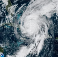
Tsunamis such as the one that devastated parts of Japan in March could be monitored by an early-warning system based on radar measurements, claims a group of geoscientists.
Large tsunamis can be triggered by a number of geological phenomena, including earthquakes, landslides and the eruptions of marine volcanoes. When triggered in the deep ocean, these waves can travel at speeds in excess of 800 km per hour, but because of their very long wavelengths their amplitudes at the surface of the water are very small, which makes them difficult to detect. As a tsunami approaches land, most of its energy becomes focused into one giant wave, often with devastating results.
To limit the impacts of these hazards, national authorities need to identify any tsunamis as early as possible and to gain an idea of what profile the giant waves will take when they strike the coast. In regions with relatively steep continental shelves, such as the west coast of the US, some quantative real-time observations of tsunamis have been possible using deep-water pressure sensors to observe changes in the elevation of the sea surface. But in regions with wider, shallower continental shelves, such as South East Asia and the east coast of the US, the effectiveness of these systems is limited.
Signature currents
Now, an alternative method based on radar has been developed by a group of researchers in California, working with colleagues in Japan. The technique capitalizes on the fact that networks of coastal radar systems are routinely used by many countries to measure surface currents. Rather than tracking the tsunami directly, the technique uses these signals to identify unusual current flows that are generated by the giant waves as they propagate across the ocean.
In demonstrating the feasibility of their technique, the researchers say that they were able to recreate a profile of the recent tsunami in Japan, which was triggered on 11 March by a magnitude 9.0 earthquake off the coast of Sendai. They analysed data captured by five high-frequency radar sites spanning 8200 km located on the coasts of Japan and California. By combining three different types of analyses the researchers were able to identify the tsunami using three different frequencies of radar signal: 5 MHz, 13.5 MHz and 42 MHz.

The researchers report their findings in a paper published in Remote Sensing under the lead authorship of Belinda Lipa of Codar Ocean Sensors in California. They say that the Japanese tsunami could have been detected up to 45 min prior to its arrival at the nearest tide gauge – devices used to measure sea levels and detect tsunamis. The researchers make it clear, however, that the signals can only be detected once the tsunami reaches a continental shelf. This is why the technique could offer the earliest warning when tsunamis pass through wide shallow shelves such as those off the coast of Japan and the UK.
“Because of the diversity in local bathymetry [water depth], there is considerable variation in the warning time available” write the researchers. These times, they say, vary “from minutes on the US Pacific coast to hours for some areas of the Atlantic coast and South East Asia”.
Christophe Vigny, a seismologist at the Ecole Normale Supérieure (ENS) in Paris, believes that the new system is promising because it uses shore-based instruments, making it easier to maintain than oceanic systems. “A tsunami detected by a ground network is certainly something that people might trust more than a probability of something happening,” he says. Vigny cautions, however, that the system still needs to be demonstrated in real time before it can be considered effective.
Lipa and her team now intend to develop their research through further study of data from coastal radar on the shores of the north Atlantic. They say that a more detailed analysis of the weaker radar signals could lead to a unique view of the propagation of a tsunami and its interaction with the ocean floor.