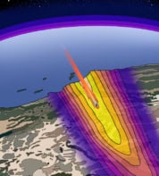
Cellular communication networks can be used to accurately predict large-scale rainfall distribution patterns in real time, according to researchers in the Netherlands. The team created rainfall maps for the whole of the Netherlands by using data from a mobile network in the country. This was based on measurements of the attenuation of microwave signal levels across 2400 network links over a four-month period. The resulting maps had a strong correlation with the same measurements taken by the conventional techniques of weather radar and rain gauges.
Predicting precipitation
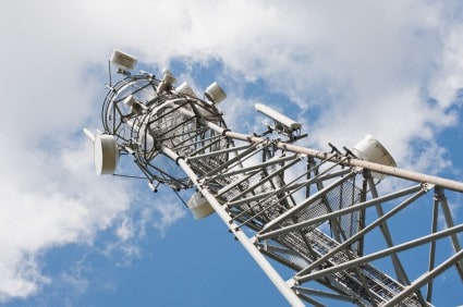
The research was carried out by Aart Overeem and colleagues, from both Wageningen University and the Royal Netherlands Meteorological Institute. “Microwave links are used in telecommunication networks to transmit signals from the antenna of one telephone tower to the antenna of another telephone tower,” says Overeem, who led the study. “When it rains the signal is attenuated, which is noticed as a decrease of the received power measured by these telephone towers. The average rainfall intensity…can be computed from the decrease in power during rainy periods with respect to the power during dry periods.”
The team looked at the minimum and maximum received signal power at each telephone tower over 15 minute periods. Passing through falling raindrops absorbs part of the incident microwave transmission and causes minor beam scattering, lowering the power that ultimately reaches the receiving tower. The more raindrops in the beam’s path – or the larger the drops are – the more signal power is lost.
By comparing received powers for each network link with reference values for known dry periods – and factoring in accounts for humidity and the water films that can develop on the communications antennae – rainfall densities along each path can be calculated. These values are then treated as point measurements at the centre of each network link and used to extrapolate the larger rain distribution maps. In the frequencies employed in these links, attenuation caused by raindrops is the main source of power reductions, beyond free space losses. Typically, the microwave network links operate at least 10 m off the ground and use frequencies between 13 and 40 GHz.
Reasons for rain reporting
Measurements of precipitation rates are essential for agriculture, weather forecasting and the management of water resources and, in the long run, for climate-based studies. Also, rapid rain reporting can be vital in minimizing the loss of life in flood-prone regions. The researchers point out that their new technique is based on measurements that telecommunication companies often already take to monitor the stability of the microwave links in their networks. The team suggests that this approach – using pre-existing resources – could thus help to ease the reliance on the rapidly falling number of rain gauges worldwide.
It is estimated that the total number of rain gauges in Europe, Africa and South America has fallen by around 50% in the last 17 years. In contrast, the spread of mobile networks continues to increase and, while they are more comprehensive in urban areas, it was estimated that in 2007 they covered around 20% of the land-based surface of the earth.
Scarcity of measurements
“More than 25 years ago it was estimated that if you put all the world’s rain gauges together in a single place they would barely fill a football pitch,” explains Dominic Kniveton, a professor of climate science at the University of Sussex. He goes on to say that globally, the area covered by surface-based rainfall radar measurements would only be approximately 4%. “I can confidently state that little has changed since in this scarcity of measurements: this remains one of the major challenges to providing high-quality climate services.”
Kniveton told physicsworld.com that “the technique shown by Overeem et al. presents an exciting addition to efforts to measure rainfall. By virtue of coming from the cellular-phone networks these measurements potentially can be harnessed using fast hydrological models. With such techniques, and the rise of mobile networks, this opens a range of possibilities to help build the resilience of many to increasing climatic hazards with climate change”.
In addition, weather radar readings are often fine-tuned using local readings from gauges. This is especially useful at greater distances from the radar. In countries where radar is frequently used, communications network data thus have the potential to be combined with radar measurements for increased accuracy.
The team is to continue its research, Overeem reports. Future work aims to improve on the algorithms used to calculate the rainfall distribution by looking at communications network data over longer periods, such as across one whole year.
The research was published in the journal Proceedings of the National Academy of Sciences.


