A thin, low-viscosity layer at the base of a tectonic plate has been imaged at a depth of 100 km beneath North Island, New Zealand, by an international team of researchers. Using underground dynamite explosions, the high-resolution seismic imaging – which has revealed previously unknown information about what happens underneath tectonic plates – may help to explain how tectonic plates are able to slide.
While the movement of tectonic plates across the Earth’s surface has long been studied, some underlying features of the process are not understood, leaving many questions unanswered. Developing an improved understanding of the lithosphere–asthenosphere boundary is essential. Previous approaches to studying these depths have been based on the recording of seismic waves, sourced from distant earthquakes, which have been reflected from the boundary up to the surface. As the waves travel they split into both longitudinal and transverse waves, which travel at different speeds. The relative arrival times reveal the depth of reflective boundaries, while the shape of the converted waveforms offers information on each boundary’s sharpness. With a wavelength of 10–40 km, however, such waves offer only low-resolution imaging.
Slipping plates
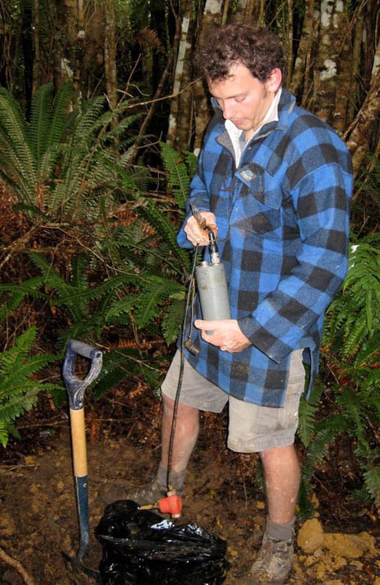
“The idea that the Earth’s surface consists of a mosaic of moving plates is a well-established scientific paradigm, but it had never been clear about what actually moves the plates around,” says Tim Stern, a geophysicist at Victoria University of Wellington. To obtain a clearer picture, Stern and colleagues used man-made, higher-frequency seismic waves, with a wavelength of around 0.5 km, generated by setting off explosions at the bottom of boreholes 50 m deep. A similar technique is commonly used in the petroleum industry in exploration.
To measure the reflected waves, the team laid out 877 portable seismographs along a 85 km line at the bottom of New Zealand’s North Island, in a region where the 120 million-year-old Pacific Plate and Hikurangi Plateau are subducting under continental New Zealand. This region was chosen because it meets a combination of useful criteria – an oceanic plate, with a shallow-enough dip to be seismically imaged, under a continental landmass on which sizable dynamite explosions can be detonated.
Boundary reflections
Originally, the researchers had only set out to image the boundary between the subducting Pacific plate and the Australian plate that lies over it. Their aim was to learn more about the plate interface, which lies at a depth of 15–30 km, and the potential risk it poses to the nearby Wellington region. “The big surprise was getting the coherent reflections from the lithosphere–asthenosphere boundary in the first place,” says Stern. “We just happened to run long records after each explosion, and were surprised to see these much deeper (~100 km deep) reflections emerge.”
At this depth, the researchers’ analysis revealed not only a boundary (<1 km) between the plate and the underlying mantle – contrasting with previous models of a simple thermal boundary transition – but also a 10 km-thick sheared channel underneath. From the decrease in seismic velocity, the team inferred it to be a low-viscosity layer. This may possibly represent a phase change to rock with a small percentage of melt or water content, pooled by plate motion through a process referred to as “strain localization”.
Push or pull?
With similar layers having also been proposed elsewhere – including a thicker channel beneath a younger section of the Pacific plate and a possible channel at the base of a continental plate off the Norwegian coast – the researchers suggest that such channels could be a universal feature of the lithosphere–asthenosphere boundary. Such a finding would help support the proposed “slab-pull mechanism” of plate tectonic movement – allowing the plates to glide with little resistance over the asthenosphere with subduction driven by their own weight. The layer would also serve to decouple the plates from the underlying mantle, making the convection-driven theory of plate tectonics – wherein the driving force is thought to be large-scale convection currents in the upper mantle that are transmitted through the asthenosphere – less probable.
“The results are striking. Changes in seismic velocity have to occur more rapidly (over distances less than 1 km) than previously suggested in order to generate the reflection,” says Stewart Fishwick, a geophysicist at the University of Leicester in the UK who was not involved in this study. He adds that “further interpretations suggest a very thin (less than 10 km) low-viscosity channel, which has implications for the dynamics of the mantle”.
The researchers are now looking at the possibility of reproducing their study perpendicular to the current line, along the strike of the eastern North Island. In addition, the team will also be exploring how such a low-viscosity channel might form.
The research is described in Nature.