Update: Here is the latest image from the European Space Agency’s Envisat satellite, taken yesterday afternoon. A plume of brownish-grey ash from the Eyjafjallajökull volcano can be seen leaving Iceland in a roughly south-easterly direction.
(Edited 20 April 2010 – the original story follows below.)

New satellite image of ash spewing from Iceland’s volcano.
(Image acquired 19 April 2010, 1:45 PM) Credit: ESA
Volcanic ash cloud as viewed from space.
(Image acquired 15 April 2010, 12:25 PM) Credit: ESA
By Louise Mayor
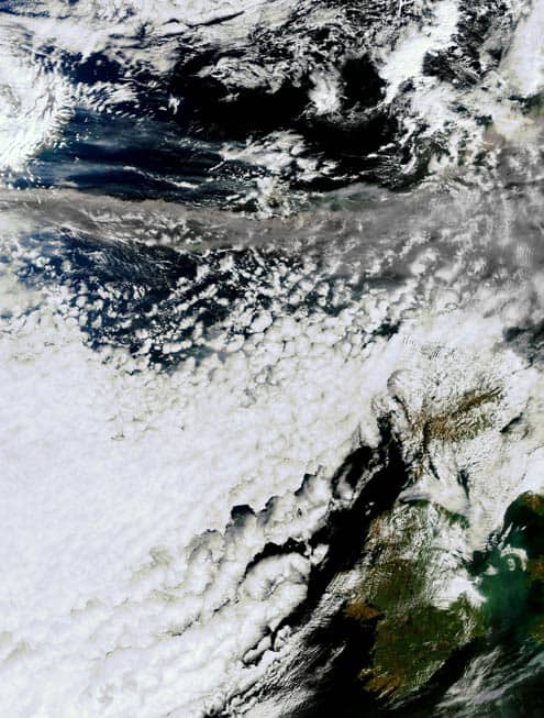
This image, taken yesterday, shows the extent of the volcanic ash that has been spewing out of Iceland’s Eyjafjallajökull volcano since Wednesday. The ash, which contains tiny particles of rock and glass, can be seen as a grey streak in the upper half of the image, being swept by winds high in the atmosphere towards the rest of western Europe.
In the bottom-right of the image you can just about make out the Republic of Ireland, and the UK where all but a few individually permitted flights have been grounded for a second day running as a result of the ash cloud.
The picture was acquired by the Medium Resolution Imaging Spectrometer (MERIS) on board the European Space Agency’s Envisat satellite. Launched in 2002, the satellite’s primary purpose is to image the colour of the Earth’s oceans using 15 spectral bands over the 390–1040 nm range. These images reveal characteristics of water such as its concentration of chlorophyll, which can then be used to understand the role of our oceans in the carbon cycle.