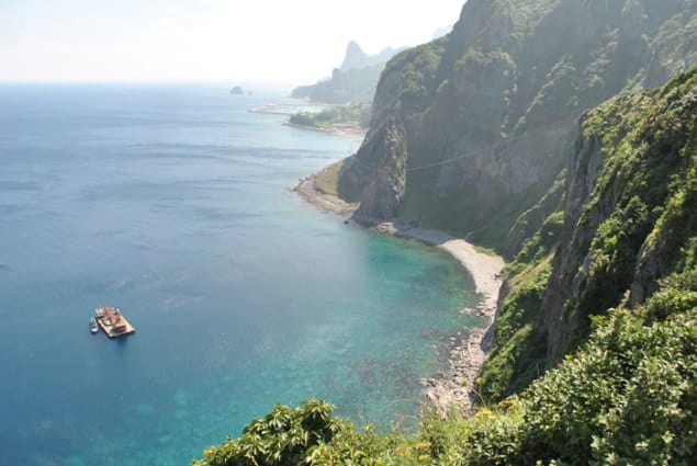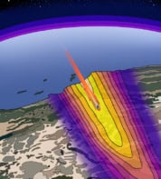
An unexpected and massive reservoir of magma could be lurking under the South Korean island of Ulleung-do in the Sea of Japan. The surprise feature has appeared in a new seismic-tomography model of the region that was created by geophysicists in Switzerland and the Netherlands. Their new tomography technique could also improve our understanding of the earthquakes that occur in this region.
The region around the Japanese Islands is of considerable interest to geologists because it lies at the intersection of several tectonic plates. At these converging plate boundaries, rock is moving down into the mantle – resulting in a high occurrence of major earthquakes and the formation of arcs of volcanoes. To better understand these dangerous phenomena – especially the rupture processes that lead to large earthquakes – many attempts have been made to image the crust and mantle around Japan.
Images are made using seismic tomography – a method that uses seismic waves, generated by either earthquakes or explosions, to create 3D models of the Earth’s structure. This is done by solving an “inverse problem” to determine the locations where the seismic wave paths are reflected and refracted as they travel between different types of material.
Low-velocity regions
This reflection and refraction is governed by the relative speed of sound in different materials. Cool, dense and solid materials appear as regions with relatively high-velocity seismic waves. High-velocity regions (called “anomalies”) can be associated with large slabs of rock moving downwards. Conversely, regions that support relatively low-velocity seismic waves tend to be hot and include some partially melted material. The low-velocity regions’ anomalies are often found below volcanic regions.
In their new study, computational seismologists Saulė Simutė and Andreas Fichtner of the Swiss Federal Institute of Technology in Zurich and colleagues used an advanced form of tomography called full-waveform inversion to study the region surrounding Japan. Unlike traditional tomographic imaging, this technique uses complete seismic recordings. It also employs more accurate wave-propagation physics – based on a numerical solution to the seismic-wave equation – to provide improved seismic resolution.
“While the basic theory behind full-waveform inversion was developed several decades ago, it is only recently that computational resources [have] increased to a level that allows one to perform full-waveform inversion on regional to global scales,” explains Simutė.
The study used seismic data from 58 different earthquakes and involved looking at a total of 5500 waveform data sets. These were used to iteratively improve seismic-wave simulations and – after clocking an enormous 10 million central-processing-unit (CPU) and graphics-processing-unit (GPU) hours on two different supercomputers – create a structural model to match the data.
Fluid-induced upwelling
As expected, the simulations revealed the high-seismic-velocity signals of the known Pacific and Philippine lithospheric slabs under and around the Japanese Islands. The researchers were very surprised, however, to also detect a large region where the shear-wave velocity is as much as 19.5% lower than expected. This anomaly begins at a depth of around 50 km beneath the island of Ulleung-do and is likely to be a reservoir of partially molten rock around 300 km wide by 100 km deep. This Ulleung-do anomaly is, the researchers believe, caused by fluid-induced upwelling from the rapidly descending Pacific slab, and might possibly be related to the extinct volcano on Ulleung-do, which last erupted 5000 years ago.
Nicholas Rawlinson – a geophysicist from the University of Aberdeen – calls the finding of the Ulleung-do anomaly “striking”. While noting that quantitative-resolution tests on the researchers’ data appear to constrain the anomaly quite well – and that previous work suggests that even 1% of partial melt in the upper mantle can decrease shear-wave velocity by almost 8% – he cautions that he is “[not] aware of any studies that have found anomalies in the upper mantle as large as this, and further work may be required to convince the community of the veracity of this outcome”.
Simutė points out that the Ulleung-do anomaly could be caused by a 1–2% partial melt, so calling it a magma reservoir “is a little bit of an exaggeration”. She also says that another mechanism – grain-boundary sliding – can explain the low velocities equally well.
Dapeng Zhao – a geophysicist at Tōhoku University – notes that the interpretation of the Ulleung-do anomaly as fluid upwelling from the Pacific slab is consistent with his tomographic studies on the origins of active volcanoes around north-east Asia. He says that the quality of the tomographic model looks good at shallow depths – showing the two descending slabs as continuous high-velocity zones. However, he adds that “the slabs look intermittent in the deeper parts under some areas. If the slab images can be further improved in future studies, that would be great.”
With their initial study complete, Simutė and colleagues are now comparing the Ulleung-do anomaly with similar, smaller low-velocity anomalies under the Mediterranean – with the aim of better understanding its nature and, in particular, why it leaves such a weak impression on the Earth’s surface. At the same time, the team will be putting its 3D structural model to use in earthquake-source inversions. This will allow the researchers to better characterize the seismic sources, but also to then better refine their seismic tomography model.
The research is described in the Journal of Geophysical Research.


