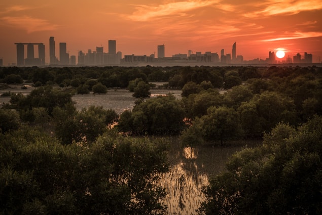
Rates of growth and loss in mangrove forests are higher than previous estimates, according to satellite measurements of the Rufiji, Zambezi, Ganges and Mekong deltas. And natural expansion and growth of new mangrove forests could partially compensate for declines caused by human activity.
“What we see for these types of mangrove delta regions is that there is rapid expansion and growth — in about 20 years, forest canopies can reach a mature height of over 20 m,” says David Lagomasino from the University of Maryland and the NASA Goddard Space Flight Center, both in the US. “In some places that fast growth can help to offset the losses, both in terms of extent of the forests and carbon density.”
Mangrove forests make up a relatively minor part of the Earth’s total forested area, but their importance exceeds the scale of their footprint. They sequester proportionally more carbon than almost any other ecosystem — their maximum storage potential above and below ground is more than 1000 tonnes per hectare – and they provide food, shelter, fuel and coastal protection.
Mangrove extent is decreasing due to urbanization and expanding agriculture and aquaculture but natural coastal processes like erosion and deposition also play a role.
By measuring changes in mangrove area and height at four major river deltas, Lagomasino and colleagues discovered that, although there was a net loss of carbon across the study areas, this was partially balanced by the growth and spread of forests elsewhere in the same regions.
The researchers examined satellite images of the Rufiji delta in Tanzania, the Zambezi delta in Mozambique, the Ganges delta in Bangladesh, and the Mekong delta in Vietnam, captured between 1995 and 2000. They identified pixels corresponding to forest using the normalized difference vegetation index (NDVI) — a method based on the ratio of red and infrared wavelengths characteristic of plant leaves. Then they took the change in forested area as the difference between this reference NDVI signal and that for the years 2000 to 2016.
The amount of carbon that an area of forest stores depends on its height and density, but in situ studies are prone to bias because of access and logistics issues. To get a more representative view, the researchers used canopy-height measurements from satellite radar observations, matching them to the changing mangrove coverage.
Although radar measurements do not yet characterize mangrove forests completely, the researchers are confident about their conclusions overall.
“We have compared our remote sensing-based models with the growth from individual field plots and have had very similar values,” says Lagomasino. “Though there are differences in the density and species of trees between young and mature forests, two forests of the same height – a young one with thousands of thin trees, and an old one with a couple hundred thick trees – may have similar amounts of carbon.”
Follow-up research will focus on what the future might hold for these regions. “Changes in the rate of sea level rise will certainly have an impact on the erosion and progradation of mangrove forests,” says Lagomasino. “Under certain conditions with enough sediment, a mangrove forest may expand with sea level rise, but other conditions may lead to the collapse of the ecosystem.”
Lagomasino and colleagues from the Universities Space Research Association and the Forest Service in the US, the World Wide Fund for Nature in Germany, and the University of Dar es Salaam, Tanzania reported the findings in Environmental Research Letters (ERL).


