Technical innovation has become big business in modern agriculture, where even small increases in crop yields can have a major impact on the bottom line. Environmental concerns are also driving the need to reduce the use of pesticides or fertilizers, which is demanding better monitoring systems for optimizing growth rates and detecting early signs of disease.
One of the newly adopted tools for remotely assessing the health of plants is multispectral imaging, which measures the light reflected by fields and orchards over different wavelength ranges. Changes in reflectance can indicate that crops have become stressed, prompting field teams to investigate and potentially intervene before a small-scale problem becomes more widespread.
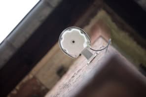
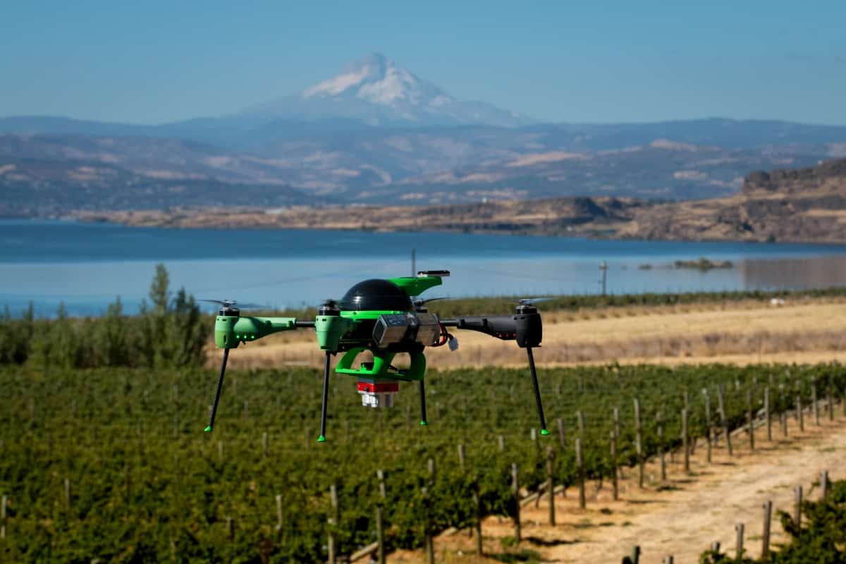
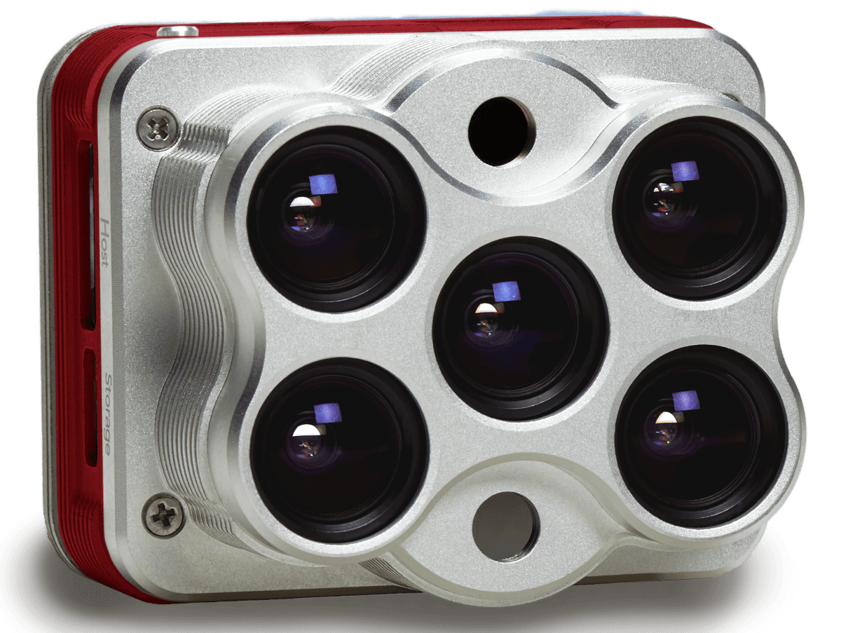
“Sick plants and healthy plants reflect light differently,” explains Dr Manal Elarab, director of enterprise solutions at MicaSense, which since 2014 has produced multispectral sensors for agricultural applications. “Our sensor is designed to be flown over plants or crops using a drone, capturing data over five spectral bands that are particularly relevant for plant canopy analysis.”
Five spectral bands
Along with visible imaging at red, green and blue wavelengths, the camera records data in the near-infrared and the red-edge region. This red-edge spectral band is particularly important for detecting changes in the reflectance of vegetation, since chlorophyll in the leaves absorbs visible light but becomes almost transparent at wavelengths greater than 700 nm.
It’s fitting, then, that MicaSense named their debut product RedEdge when it was first launched in 2014. Several iterations later, the RedEdge camera has become the go-to multispectral instrument for scientists who specialize in studying and improving the performance of plant-based crops. Data from the RedEdge has been exploited in more than 100 published scientific studies, and MicaSense works closely with the research community to support ongoing projects and connect different groups who are working on similar problems.
In one recent study, Dr Ray Asebedo from Kansas State University proved that data captured by the RedEdge could be used to detect disease in wheat fields earlier than other remote-sensing techniques. Mapping the area using common indices such as the Normalized Difference Vegetation Index (NDVI) showed no sign of any problems, while multispectral red-edge data revealed a small patch with different reflectance characteristics – highlighting signs of stress that manifested as chlorophyll deficiencies. Closer examination uncovered yellow streaks on the wheat, a symptom of a viral infection that would have a significant impact on yields if left untreated.
Elarab stresses that the reflectance data should not be used a standalone diagnostic, but rather as an indicator of a potential problem that can reduce the time spent manually checking the health of the crops. If a problem is detected, further analysis in the field or in the lab is also vital to understand the cause of the stress, and to devise possible solutions.
“Multispectral imaging plays a huge role in monitoring the effect of any management practice performed in the field,” Elarab continues. “It can help to determine whether the problem has been resolved, and whether the plants have regained their size and strength.” Other applications for the technology include forestry and archaeological surveys.
Putting the pieces together
Careful planning is essential to generate useful information from a flight, says Elarab. The camera must be integrated onto a suitable aircraft, the flight path must be configured to collect multiple overlapping images, and the raw data must be processed and analysed to enable decisions to be made. “I can’t claim that it’s an easy puzzle to put together, because all the right pieces need to fit together to achieve a successful output,” says Elarab. “But it’s much easier today than when I was a graduate student in 2012, and the technology is now evolving to produce real information rather than just data or pictures.”
Elarab explains that most crop studies monitor changes over time, which means that calibration is essential to correct for different weather conditions and to enable a direct comparison of data recorded over weeks or months. The sensor is therefore supplied with two calibration instruments that can correct for different light conditions between flights, and even for varying light conditions during a single flight. One is a calibration panel that can be imaged before and after the flight to measure the baseline lighting conditions, and the other is a so-called downwelling light sensor that records the ambient light in each of the five spectral bands during the flight.
Our commitment is to build the best sensor we can, while working hand-in-hand with our users to help them to achieve the best possible results from their data
Manal Elarab
The data captured by the multispectral sensor must also be processed to provide reflectance information over the area of interest. A reflectance map can be created with photogrammetric software available from several third-party vendors, who are continually developing their tools to make the data easier to use on a routine basis. Meanwhile, MicaSense provides plenty of advice and support to help customers get the most out of their data through webinars, workshops, and Knowledge Base articles.
“Our core expertise is building better sensors, but we are also committed to working with everyone else in the drone-mapping workflow to ensure that our users derive the proper information from our sensors,” comments Elarab. “We partner with processing companies to help them understand our users and their applications, allowing them to introduce better ways for our customers to unlock the full potential of their data.”
Thermal integration
But the main focus for MicaSense is improving the effectiveness of its technology. As well as regular updates to the original RedEdge camera, in 2018 the company introduced a new multispectral sensor that incorporates thermal capabilities for measuring the temperature of the crop – which can be an important indicator of water stress or disease.
“We were finding that some of our customers were buying the RedEdge and then also flying a separate thermal sensor,” says Drew Baustian, the company’s business development manager. “They would then have two separate datasets containing their multispectral and thermal data, and it was really tricky and time consuming to merge the two together.”
The new Altum synchronizes multispectral and thermal measurements and outputs into a single file, and offers a higher data resolution than that of the RedEdge. Both the Altum and the latest version of the RedEdge include an upgraded version of the downwelling light sensor, which can better estimate the light conditions during the flight and so improve the corrections that need to be made to compensate for changing conditions between flights or during the same flight.
It’s early days for the Altum sensor, which has only been available for one complete growing season in the southern hemisphere and is now being used for its first summer season in the northern hemisphere. But Elarab says the scientific community has been eager to test the new instrument in the field. “It has already been incorporated into lots of different research projects,” she says. ”There’s nothing ready for publication yet, but we’re very excited about the potential of using Altum to combine high-resolution multispectral data with thermal measurements.”
The company is now working to offer users greater flexibility for their data capture, rather than restricting them to the five pre-defined spectral bands provided by the RedEdge and Altum instruments. “Researchers often have related applications that require a slightly different spectral band,” says Baustian. “We have never really addressed that demand, so we’re looking at offering another configuration over the next 12 months or so.”
Elarab believes that this continued innovation will open up new scientific opportunities, while also delivering new solutions for farm managers and agricultural service providers. “We want more people to adopt precision agriculture,” she says. “Our commitment is to build the best sensor we can, while working hand-in-hand with our users to help them to achieve the best possible results from their data.”