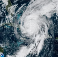
An international team of scientists has performed the most comprehensive analysis to date of the earthquake that caused the devastating Indian Ocean tsunami in December 2004. The results, based on data from more than 60 Global Positioning System (GPS) monitoring stations across Southeast Asia, indicate that the rupture along the seafloor was at least 1000 kilometres long and that it propagated extremely quickly (Nature 436 201).
Earthquakes occur because pressure builds up as the continental plates that make up the Earth’s crust move relative to one another. The magnitude 9 earthquake of 26 December 2004 occurred at the fault line where the India and Burma plates meet. It was the fourth largest earthquake since 1900.
Christophe Vigny of the Ecole Normale Supérieure (ENS) in Paris and colleagues in Malaysia, Thailand, Indonesia and the Netherlands compiled data from GPS sites positioned at distances between 400 and 3000 kilometres from the epicentre of the earthquake, which was off the west coast of northern Sumatra. They measured the distance each GPS station moved in response to the earthquake and then used this displacement to test different models of earthquakes.
The team found small but significant jumps of between 5 and 10 millimetres at stations as far as 3000 kilometres from the epicentre. However, sites that were nearer — but still at more than 400 kilometres away — showed large displacements: 27 centimetres in Phuket in Thailand, 17 centimetres on Langkawi Island in Malaysia and 15 centimetres in Sampali in Indonesia.
According to Vigny and co-workers the data are best explained by a model in which the rupture was 1000 kilometres long and spread rapidly northwards from its origin. This is revealed by GPS stations in northern Thailand that reached their final positions less than 10 minutes after the earthquake occurred. This rules out the possibility that the earthquake was caused by a slow “aseismic” rupture. Moreover, the GPS data show that the centre of the deformation caused by the earthquake is located at least 200 kilometres north of its epicentre.
“We observed the arrival times of surface waves using kinematic processing of the GPS data, which is something that has never been done before,” Vigny told PhysicsWeb. “This opens up a new field in seismology because seismographs do not normally measure static displacements.”
The team is continuing to take data from the GPS stations on a daily basis to quantify post-seismic deformation. It will use these measurements to monitor changes in the Earth’s crust, which will continue for years to come, and perhaps predict when future earthquakes might occur.