The first clear images of Yellowstone’s shallowest magma reservoir have revealed its depth with unprecedented precision, providing information that could help scientists determine how dangerous it is. By pinpointing the reservoir’s location, geophysicists and seismologists from Rice University and the universities of Utah, New Mexico and Texas at Dallas, hope to develop more accurate predictions of when this so-called “supervolcano” will erupt again.
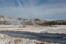
Yellowstone is America’s oldest national park, and it owes its spectacular geysers and hot springs to its location above one of the world’s largest volcanoes. The last major eruption of the Yellowstone supervolcano happened around 630 000 years ago, and was violent enough to create a collapsed crater, or caldera, over 60 km across. Though it shows no sign of repeating this cataclysm anytime soon, it is still an active volcano, and it is slowly forming a new magma reservoir.
Previous estimates of the depth of this magma reservoir were highly imprecise, ranging from three to eight kilometres. Scientists also lacked an accurate location for the reservoir’s top and were unsure how its properties changed with increasing depth.
The latest results, from a team led by Brandon Schmandt and Chenglong Duan at Rice and Jamie Farrell at Utah, show that the reservoir’s top lies 3.8 km below the surface. They also show evidence of an abrupt downward transition into a mixture of gas bubbles and magma filling the pore space of volcanic rock. The gas bubbles are made of mostly H2O in supercritical form and the magma comprises molten silicic rock such as rhyolite.
Creating artificial seismic waves
Duan and colleagues obtained their result by using a mechanical vibration source (a specialized truck built by the oil and gas firm Dawson Geophysical) to create artificial seismic waves across the ground beneath the northeast portion of Yellowstone’s caldera. They also deployed a network of hundreds of portable seismometers capable of recording both vertical and ground vibrations, spaced at 100 to 150-m intervals, across the national park. “Researchers already knew from previous seismic and geochemical studies that this region was underlain by magma, but we needed new field data and an innovative adaptation of conventional seismic imaging techniques,” explains Schmandt. The new study, he tells Physics World, is “a good example of how the same technologies are relevant to energy industry imaging and studies of natural hazards”.
Over a period of a few days, the researchers created artificial earthquakes at 110 different locations using 20 shocks lasting 40 seconds apiece. This enabled them to generate two types of seismic wave, known as S- and P-waves, which reflect off molten rock at different velocities. Using this information, they were able to locate the top of the magma chamber and determine that 86% of this upper portion was solid rock.
The rest, they discovered, was made up of pores filled with molten material such as rhyolite and volatile gases (mostly water in supercritical form) and liquids in roughly equal proportion. Importantly, they say, this moderate concentration of pores allows the volatile bubbles to gradually escape to the surface so they do not accumulate and increase the buoyancy deeper inside the chamber. This is good news as it means that the Yellowstone supervolcano is unlikely to erupt any time soon.
Geophysical surveys reveal Yellowstone’s hydrothermal underworld
A key aspect of this analysis was a wave-equation imaging method that Duan developed, which substantially improved the spatial resolution of the features observed. “This was important since we had to adapt the data we obtained to its less than theoretically ideal properties,” Schmandt explains.
The work, which is detailed in Nature, could also help scientists monitor the eruption potential of other volcanos, Schmandt adds. This is because estimating the accumulation and buoyancy of volatile material beneath sharp magmatic cap layers is key to assessing the stability of the system. “There are many types of similar hazardous magmatic systems and their older remnants on our planet that are important for resources like metal ores and critical minerals,” he explains. “We therefore have plenty of targets left to understand and now some refined ideas about how we might approach them in the field and on the computer.”