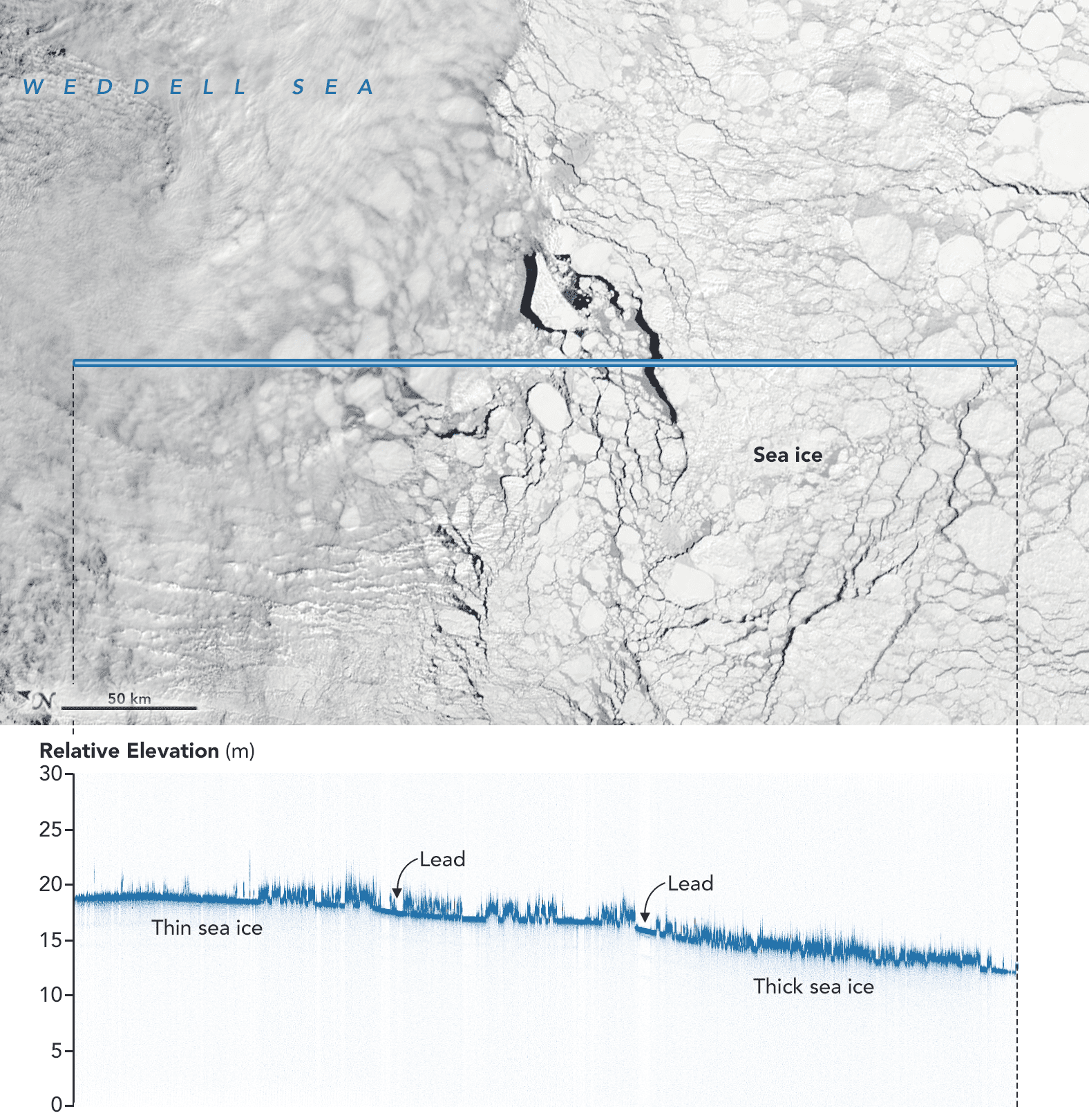
At the AGU Fall Meeting in Washington DC, NASA displayed images from its Ice, Cloud and land Elevation Satellite-2 (ICESat-2), which launched less than three months ago. The ATLAS (Advanced Topographic Laser Altimeter System) instrument onboard bounces a pulse of visible green laser light split into six individual beams off the Earth’s surface and measures the time for individual photons to return.
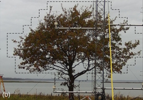
Not only can ATLAS measure ice elevations with an accuracy of roughly 1 cm to reveal ice structure, leads and more, but it also shows vegetation heights and, when the water is not too turbid, the depth of the ocean floor, as these images show.