Earthquake ground-motion predictions rely on statistical models built on historical records. This means that ground-motion measurements taken during previous earthquakes are used to predict the effects of future earthquakes. However, historical data can be sparse in some locations and if a region has not experienced a severe earthquake in the modern era, there will be no data for high-magnitude events. As a result, seismologists are keen on using physics-based simulations to predict ground motions, essentially filling in the gaps in historical datasets.
Although physics-based simulations of ground motions have been in development for while, they have rarely been used for engineering applications or building code development. With advancing computational capacities and geophysical understanding of earthquake cycles, the development and application of physics-based simulations have seen a surge of energy in the last few years.
As someone working with physics-based ground motions and enthusiastic about the latest research in the field, I arrived in Portland, Oregon in July for the quadrennial US National Conference on Earthquake Engineering (NCEE) hosted by the Earthquake Engineering Research Institute. This was my third NCEE – I was about to start my PhD when I attended the first time in 2018 in Los Angeles.
After a series of delays during my flight from London, I finally arrived in Portland in the quiet hours of the night. Only realising that I had about six hours before the first session starts in the morning.
Understanding the challenges
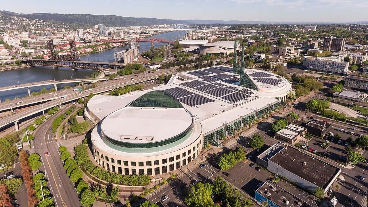
Regardless, I reached the venue at 9 am sharp, the Oregon Convention Center, with swollen (and perhaps red) eyes, to attend a workshop on “Earthquake ground motion simulation validation & utilization for engineering applications”. I was keen to understand why the validation and application of simulated ground motions are still challenging despite advancements in research and tools for simulations. A little sleep deprivation through jetlag did not deter me.
Current ground-motion models are used within a probabilistic framework, along with models of the fault systems and the earthquake magnitudes they can generate, to define probabilities of expected ground shaking. These statistical models do not capture the geophysical process but instead rely on a curated dataset collected in the short history of earthquake recordings. These datasets, likely, do not contain all possible earthquake magnitudes and ground shaking. Models based on these data are prone to bias, especially for scenarios where data are sparse. For example, the data gap is stark for higher magnitudes at shorter distances from the source, since we have only seen a handful of large earthquakes after earthquake recording started in the last century.
Physics-based simulations can meaningfully augment these datasets, and in turn, improve conventional ground motion models. Many such efforts have been made globally in the past decade. My PhD research deals with built environment impacts from a simulated magnitude 9 Cascadia subduction zone, which runs hundreds of kilometres along the coast of the Pacific Northwest of the US and southwestern Canada. Indeed, the subduction zone is about 200 kilometres west of where the conference was happening. Although this fault has never produced a magnitude 9 earthquake, or any significant earthquake, in the last century, there is geological evidence of several large magnitude earthquakes over a period of thousands of years.
“Different answers”
My research involved understanding how the built environment would be impacted by such a large earthquake on this fault. That research, and many others, showed that we can gain nuanced understanding of how ground shakes, impacts the built environment and cascades into landslides and tsunamis after an earthquake. As Stanford University’s Greg Deierlein, said during the workshop, “Simulations are most useful when they provide different answers compared to conventional methods.”
Despite their promise, physics-based simulations remain unused in most national seismic hazard models. And where they are used, the scale is negligible. The ingredient that is missing is trust – whether the simulations can represent complex fault geometry and rupture mechanism, how reliable are the velocity structure models, can the simulations reproduce empirical data. Trust, within the community of researchers and practitioners, is built on testing and validation.
Seismic waves reflected from Earth’s core moved parts of Japan 5 mm east
Aptly, there was engaging discussions during the workshop around standardized validation protocols and open repositories of reproducible workflows. One key challenge for physics-based simulations is to establish that simulated ground shaking scales across various parameters in patterns that is empirically observed in the recordings. As Jonathan Stewart at the University of California Los Angeles, pointed out, “the trust on absolute amplitude [from physics-based simulations] is low, however, how does the [simulated] ground motion scale across various parameters is what is valuable.”
There was at least one session each day discussing methods of developing, validating, and applying physics-based simulation of ground motions. I presented my work on the final session, a closing act if you will, on using the simulated ground motions to reveal damage patterns across a building portfolio that conventional ground motion models cannot capture. It implies that we may have two very different views of risk depending on which models we use. This would make it challenging for insurance companies to correctly price the risk and for future infrastructure developments in the region.
With more encouragement and more questions than answers, I wrapped up five long-days of exchanging ideas, discussing careers, and catching-up with friends. While walking past beautiful murals and aisles of books in Powell’s Books on my last evening in Portland, I wondered how far simulated ground motions will travel by the time I come back for the next NCEE four years from now.